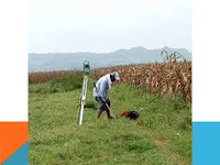
Surveying
·
Cadastral Surveys Services
Our cadastral mapping services support
boundary definition, registration and documentation easements. road and highway
definition, right-of-way planning and mapping, land parcel and subdivision
mapping , retracement surveys, and electric power generation, transmission, and
distribution facilities.
·
Construction and Engineering Survey
We provides expert, specialized
engineering and construction survey services to contractors, developers, and
industrial companies, including services for major plant site design-build
projects and smaller construction projects. Our specialties include commercial
and industrial buildings, resource processing facilities, bridges, roads, dams,
and municipal infrastructure. We enhance construction cost efficiencies by
establishing precise project control systems and structural layout based on a
careful analysis of the client’s requirements.
·
Engineering Survey Services
-
Horizontal
and vertical site control
-
Topographic
surveys
-
As-built
surveys
-
Hydrographic
surveys
-
Pre-engineering
surveys and site surveys
-
Layout
for earthquake and civil works
-
Volume/quality
measurements
-
Precise
layout for equipment replacement
-
Pile
layout, foundation lines, and column lines
-
Real-time
differential (DGPS) GPS application
·
Facilities
Mapping Services
-
Mapping
of electric power generation, transmission, and distribution facilities
-
Planning
and monitoring of municipal infrastructure
-
Resource
processing facilities, bridges, roads, and dams
·
Survey
Equipment
-
Total
Stations
-
Digital
Level
-
CHC RTK
GPS
-
Total
stations
·
Software
-
Autodesk
AutoCAD
-
Surfer
-
Microsoft
Office
-
Data Downloading
Software
·
Recent
Projects
Geomartins
& Associate has undertaken numerous projects, some of our recent projects
are outlined below:-
-
Perimeter
and Topographical survey of Oakwood Residential Estate, Ibeju Lekki Lagos State.
(75 Hectares)
-
Perimeter
Survey of MUNETO CONCEPT NIG. LTD property at Mukore Village off Lagos - Ibadan
Express Way, Ogun State. ( 150 Acres)
- Geotechnical,
Topographical & Detail Survey of Heritage Residential Estate, Ibeju Lekki,
Lagos State (44 Hectares)
- Perimeter
survey of ABUDU GAFARI OLOWOPOROKU ROYAL FAMILY Land at Fadagbuwa-Oriba
Village, by Eleran Igbe, Epe Lagos
-
Perimeter
survey of AGORO FAMILY, HASSAN FAMILY & JINADU FAMILY at Okun-Solu Orunmija
Village, Ibeju-Lekki Lagos. (105 Hectares)
-
Route Survey
of Ipaja Ayobo road for Lagos State Government.
·
International
Projects
We are willing to undertake projects
internationally and are presently working in taking one.
v All our surveys are presented in CAD
formats as dictated by our clients to allow immediate integration with
engineering & design package.Our expertise in developing Customized
Software and Information Systems has allowed us to satisfy our clients whose
need is to make efficient and effective use of their computers.


Comments
Post a Comment